| Burned Area, Post-fire
Effects, and Vegetation Recovery
Modeling
carbon pools and fluxes at continental scales is critical for evaluating
feedbacks in regional- and global-scale changes in climate and atmospheric
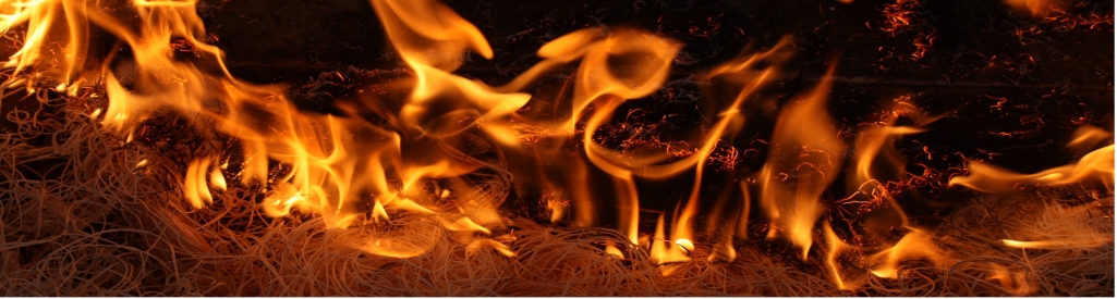
chemistry. Wildland fire is a major contributor to the dynamism of the
North American carbon budget, and because current trends in climate change
will likely result in drier North American climates with more frequent and
severe fires, the magnitude of this contribution is likely to increase (IPCC
2001). Quantifying wildfire gaseous emissions and the relative apportionment
of emitted carbonaceous gas species to the atmosphere is vital to narrowing
the uncertainties associated with key questions concerning global climate
change and atmospheric chemistry, as well as local and regional air quality.
Continental scale emission estimates are currently calculated via the
parameterization of a simple model, in which the total biomass combusted
(and consequently the gases emitted) is determined through the simple
multiplication of the area burned by the pre-fire fuel load and the
proportion of fuel combusted within the fire. Consequently the assessment of
the Area Burned, A, and the Combustion Completeness (b) are important
aspects of fire-emissions research. 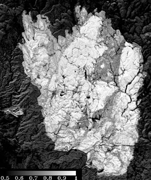
Assessment of The Area Burned. The
Forest and Rangeland Measurements Lab has investigated several novel ways to
evaluate the extent of burned area. Specifically, the lab has published
several papers researching ways to monitor burned area in Southern African
Savannahs and in North America Forests:
Smith A.M.S.,
Drake, N.A., Wooster, M.J., Hudak, A.T,. Holden, Z.A.
and Gibbons C.J.
2007 Production of Landsat ETM+ Reference Imagery of Burned Areas within
Southern African Savannahs: Comparison of Methods and Application to MODIS,
International Journal of Remote Sensing,
28, 12, 2753-2775.. (PDF)
Holden, Z.,
Smith A.M.S.,
Morgan,
P.,Rollins, M,G. and
Gessler, P.E., 2005,
Evaluation of novel thermally enhanced spectral indices for mapping fire
pereimeters and comparisons with fire atlas data,
International Journal of
Remote Sensing,
26
,217, 4801-4808. (PDF)
Smith A.M.S.,
Wooster M.J., Powell,
A.K. and Usher, D., 2002, Texture based feature extraction: application
to burn scar detection in Earth Observation Imagery, International Journal
of Remote Sensing, 23, 1733-1739 (PDF)
Ongoing
research includes the assessment of the more promising techniques to
multiple environments simultaneously, as most studies are restricted to only
evaluating restricted methods to single study environments.
Evaluation of Vegetation Recovery.
Recent research has seen the lab investigate whether remote measures of the
fraction of char (shown above for the Jasper Fire, South Dakota) and green
vegetation within burned area Landsat pixels acquired immediately post fire
can be used to predict 1-yr post-fire measures of the ecosystem recovery.
Early results are promising, with good predictive relationships observed
between the immediate char fraction and 1-yr post-fire field measures of the
weight of organic litter. For more information:
Smith, A.M.S.,
.Lentile, L.B., Hudak, A.T. and Morgan P.,
2007
Evaluation of linear spectral
unmixing and dNBR for predicting post-fire recovery in a
North American ponderosa
pine forest, International Journal of Remote Sensing,
22, 20, 5159-5166.
(PDF)
Lentile, L.B*., Smith, A.M.S*., Hudak, A.T.,
Morgan, P. and Bobbitt, M.,
[*
Equal Contribution]
Remote sensing for
prediction of 1-year post-fire ecosystem condition, International Journal of
Wildland Fire,
Accepted Pending Revisions.
|