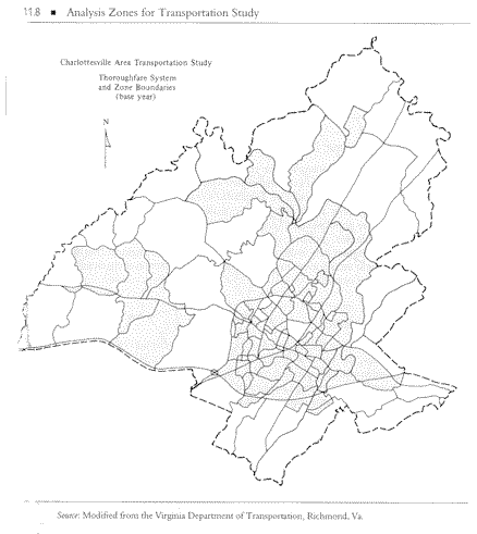
 Study Boundary Before forecasting the travel for an urban area or region, the planner must clearly define the exact area to be considered. These areas may be defined by the urban growth boundary (UGB), county lines or town centers. The planning area generally includes all the developed land, plus undeveloped land that the area will encompass in the next 20 to 30 years. The cordon line denotes the boundary of the planning area. In addition to considering future growth, the establishment of the cordon line might take into account political jurisdictions, census area boundaries, and natural boundaries. The cordon line should intersect a minimum number of roads. Zones The study area must then be divided into analysis units, or zones. This will enable the planner to link information about activities, travel, and transportation to the physical locations in the study area. The transportation analysis zones (TAZ) vary in size depending on the density or nature of the development. In an urban area the TAZ may be as small as a city block, but in rural areas the TAZ may be as large as 10 or more square miles. The zones attempt to encompass homogeneous urban activities, which are all residential, all commercial, or all industrial. Zones are designed to be relatively homogeneous traffic generators and are sized so that only 10-15% of the trips are intra-zonal. An important consideration in establishing zones is their compatibility with the transportation network. As a general rule, the network should form the boundaries of the zones. A study area that has been divided into zones is shown below.
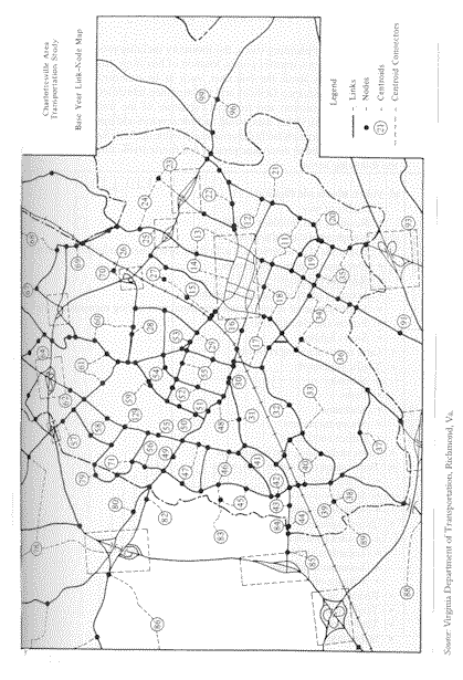
Links and Nodes Normally, a simple representation of the geometry of the available transportation systems is included on the map of the study area. A system of links and nodes, or a network, indicates roadways and other transportation routes. Links represent sections of roadway (or railway etc.) that are homogeneous, while nodes are simply points at which links meet. Usually, transit networks are developed independently of truck and automobile networks. In the network description, zone centroids (centers of activity) are identified; they are connected to nodes by imaginary links called centroid connectors. Centroids are used as the points as which trips are "loaded" onto the network. A diagram of a transportation network is shown below. The figures on this page came from:
|