Tambomachay
"...The ninth [holy place] was
named Tambomachay; it was a house of Inca Yupanpui where he lodged when
he went hunting." Bernabe Cobo, 1653.
"...that city of Cuzco was house
and dwelling of gods, and thus there was not, in all of it, a fountain
or passage or wall which they did not say held mystery." Juan Polo
de Ondegardo, 1571
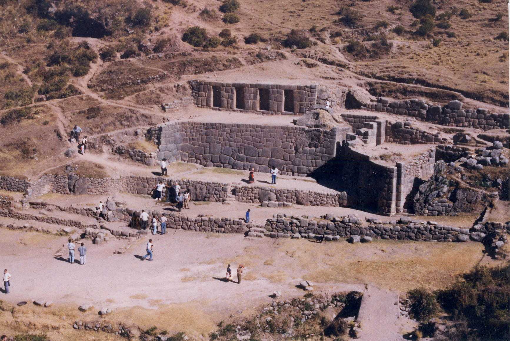
The archaeological site of Tambomachay is located about 8 km north
of the city of Cuzco, in the southern Peruvian highlands. The well-crafted
stonework, beautiful fountains, and pastoral setting on the Cachimayu ("Salt
River") combine with ease of access to make this site one of the most visited
in the area.
| High quaility stonework, a double-jam doorway, and the four large,
outward-facing niches all indicate that the site was an important shrine
to the Incas. Despite the importance of the site to the Incas, the
original name is uncertain. Cobo (1653) tells us that Tambomachay
was a house (see reference above), and there is no provision for lodging
at the present day archaeological site. It is likely that the original
name was "Quinoapuquiu". Cobo tells us that Quinoapuquiu "...was
a fountain near Tambo Machay which consists of two springs." |
 |
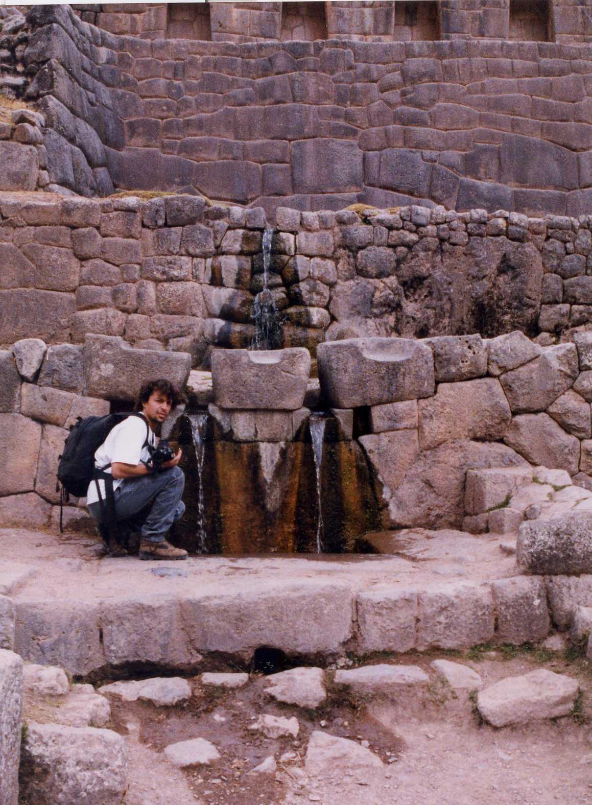 |
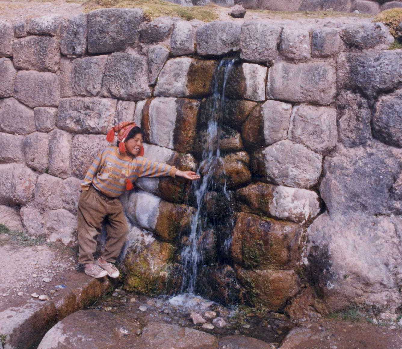
These beautiful fountains are the focal point of the site.
Set slightly off-center, the fountains make a dynamic architectural composition
that underscores the importance of the spring. The area around Cuzco
receives a yearly average of 950mm of rainfall, mostly during the few months
of monsoon season. In this semi-arid region, the spiritual treatment
of the spring is in harmony with the importance of a dependable water supply. |
| The hydrologic nature of the site captured my interest during a
visit in 1995. Since that time I have been studying the hydrogeology
of Tambomachay and other Inca sites. Understanding Inca water
management practices requires a knowledge of Inca culture, as well as a
good background in hydraulics and geology. The happy result is the
opportunity for archaeologists and hydrologists to work together and learn
from each other. Archaeohydrology, is a true multi-disciplinary area
of study. |
 |
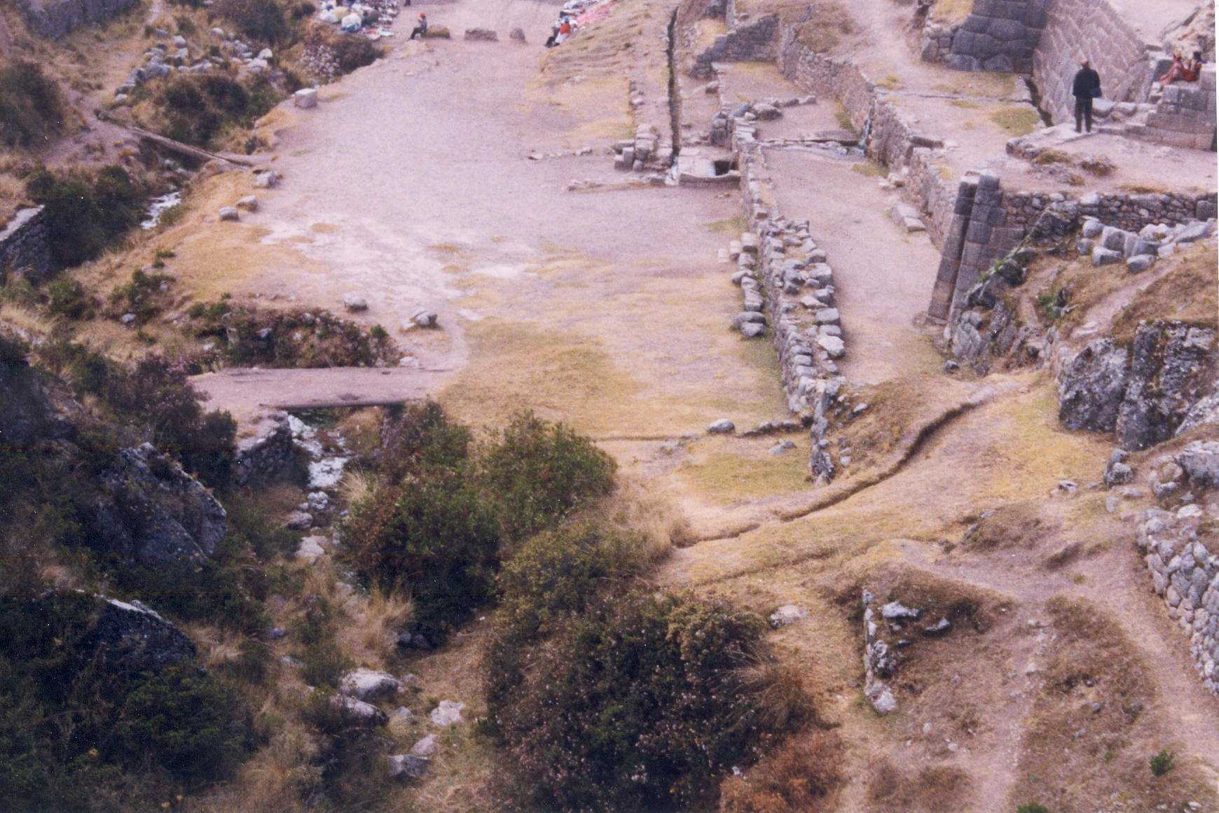 |
The image to the left shows the interaction between the groundwater
and the Inca construction. A ridge of limestone bedrock blocks groundwater
from flowing to the river (right edge of photo); a similar ridge blocks
the water on the other side of the stone walls (not visible in this photo).
The stone construction is located so as to control the discharge of groundwater
through the gap between the two limestone ridges. The Cachimayu is
dry in the foreground of the photo; however, some water is underflowing
the
walls, and can be seen discharging to the riverbed near the bridge (left
center). The walls filter and collect the groundwater, and may slow
the discharge to store water in-situ in the earth behind the walls. |
The work I have been doing at Tambomachay has only been possible
thanks to the generous funding provided by the Stahl Foundation,
and by the Earth Sciences Division of Lawrence Berkeley National
Laboratory. If you are interested in learning more about my
work at Tambomachay and other Inca sites, you can wait for my publication
in Latin American Antiquity (currently in review), or E-mail me at: jfairley@uidaho.edu.