Introduction
Wet Pond
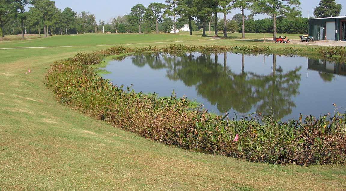
A retention basin, or wet pond, holds a volume of water until the next storm flow enters. Theoretically, the entering water forces existing water out of the pond into the receiving stream. Therefore, you can think of the retention basin as holding one or more batches of stormwater. Of course, like detention ponds, not all storms are retained. Generally only the design storm is held in the basin while larger storm volumes drain away just as with the detention basin.
In the image above there is a fringe of wetland vegetation. This is sometimes an accident of gentle basin slopes that create optimum water depths for some plant species. This can be more deliberately established by creating more or less level shelves with differing water depths above them.
Often the functions of the detention and retention basins are combined. In this model a volume of water above the permanent pool is held temporarily and then released at the predevelopment rate. You can imagine that the mixing of the inflow with the existing pool ruins the idea of a new volume pushing an existing volume out of the pond. However, a single (low velocity) inflow point at one end (called the pond head) and an outflow at the other end of the pond, rather than multiple points for each, support the batch treatment concept.
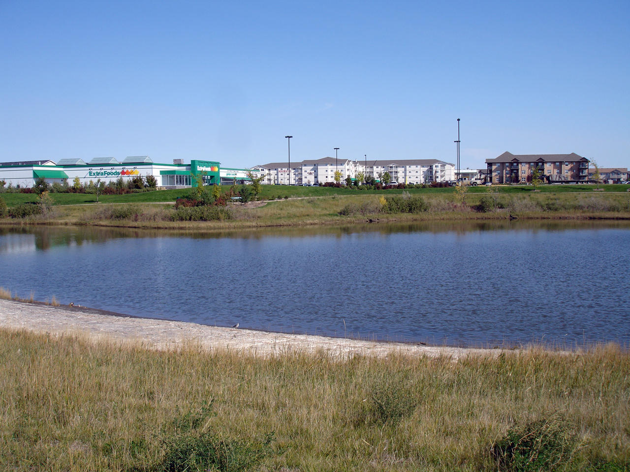
Residential Amenity
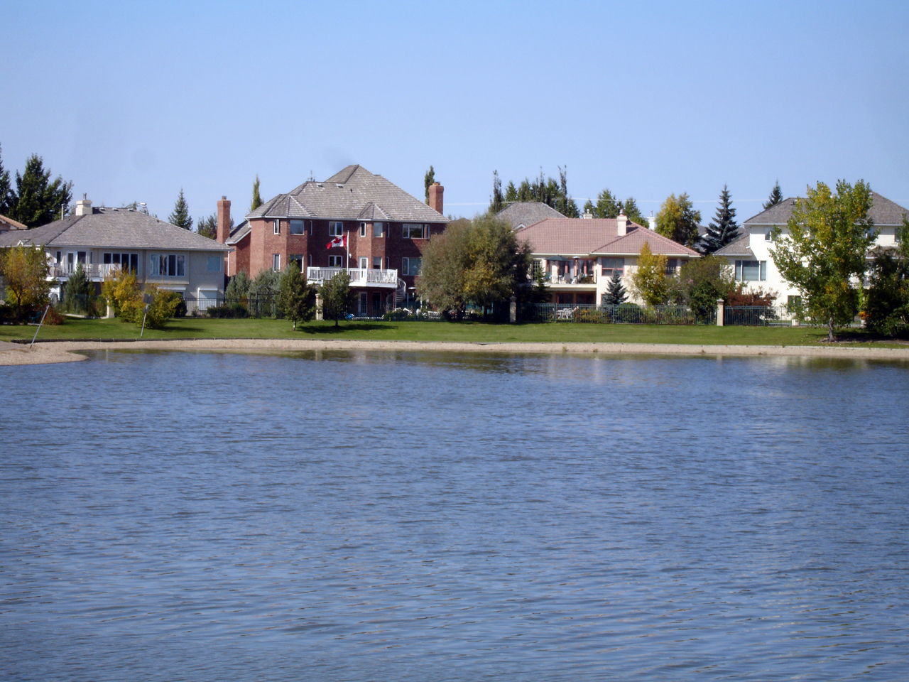
Stormwater Amenity. Briarwood Retention Basin, Saskatoon. Photo: Drm310, license CC-BY-3.0
The primary motivation for the retention basin is to create an aesthetic feature around which housing or other land-use can be arranged. Therefore, the stormwater basin can be regarded as a visual and economic amenity. The image above illustrates the great views and other amenities associated with the large retention basin. This translates into increased property value.
Public Amenity
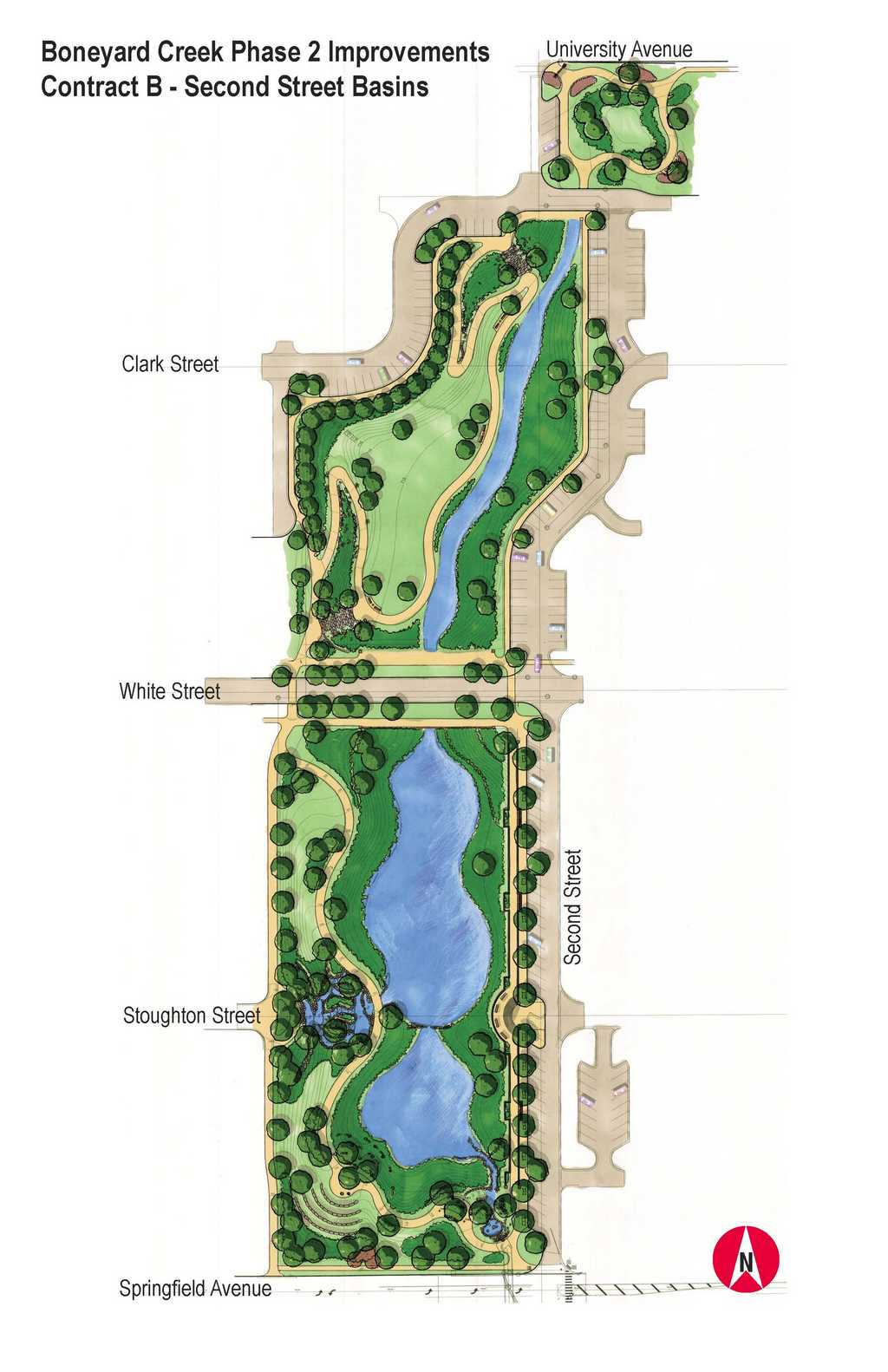
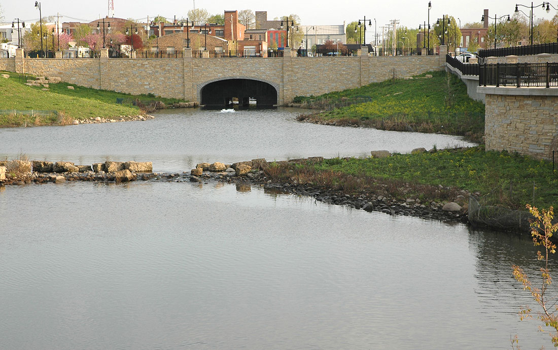
Boneyard Creek Basin. Image: City of Champaign Ill. Photo: Austin, 2012.
The plan and photo above show the Boneyard Creek Second Street Basin in Champaign, Illinois. This retention basin controls flooding in the city and is the setting for public amenities including an amphitheater, promenade (on the right in the image above), a cascading waterfall, amphitheater and other park facilities
There are actually two detention basins, one south of White Street and the second basin north of White Street. The basins are 15 to 20 feet deep and have the capacity to detain the 100-year storm (41.5 acre-feet of water) and retain a much smaller storm.
Water Quality
Trounce Retention Basin Illustrating Wildlife, Water Quality and Recreation Benefits. Photo: Drm310, license CC-BY-SA-3.0
There are potentially benefits beyond stormwater management that retention basins could offer but these vary greatly according to the basin design. Generally, retention ponds are not very effective for water quality improvement.
Small basins that hold only one batch (the design storm volume) offer little water quality benefit since frequent or long storms will result in some water receiving no treatment since it simply flows through. If the basin is designed to hold several batches, then water quality improvement increases significantly. For example, a retention basin with wetland vegetation that holds a single design storm volume (usually defined as the water quality storm, such as the 1-year, 24-hours storm) will result in pollution removal of about 20% while a similar basin that contains six water quality volumes will remove approximately 80% of the pollutants (Kadlec, 2009).
Similarly, retention basins without wetland vegetation offer little water quality benefit. In fact, like detention basins they can increase problematic substances, such as pathogenic bacteria.
Case Studies
An Australian study compared the effectiveness of a constructed wetland marsh and an open water retention pond for reductions in numbers of pathogenic bacteria. A sedimentation basin and a trash rack preceded the 3.7 acre wet pond that received stormwater runoff from a residential development. The pond was divided into three pools by 3’ tall berms but the water ranged in depth from 6.5 to 16.4 feet. The pond edge was vegetated with macrophytes (wetland vegetation).
Fecal bacteria, Entrococci (a genus of disease causing bacteria) and heterotrophic bacteria (a class that includes most bacteria) reductions were much greater in the constructed wetland than in the deep water pond. For the wetland, the outflow showed bacteria reductions of 79%, 85%, 87% for fecal coliform bacteria, Entrococci and heterotrophic bacteria, respectively. At the wet pond outlet, the bacteria either increased or were reduced much less compared to the wetland marsh. The outflow showed bacteria reductions of -2.5%, 23%, 22% for fecal coliform bacteria, Entrococci and heterotrophic bacteria, respectively, compared to the inflow (Davies, 2001).
Another study of a large stormwater retention basin found that it achieved significant reductions in only turbidity (suspended sediment) and fecal coliform bacteria counts (56% reduction), but there were insignificant reductions in ammonium, nitrate, phosphorus and total nitrogen. Water depth, lack of emergent vegetation and storm runoff inlets below the head of the pond are the most significant factors leading to the poor water quality performance of the pond (Mallin, 2002).
Stormwater Management with Bioretention Basins
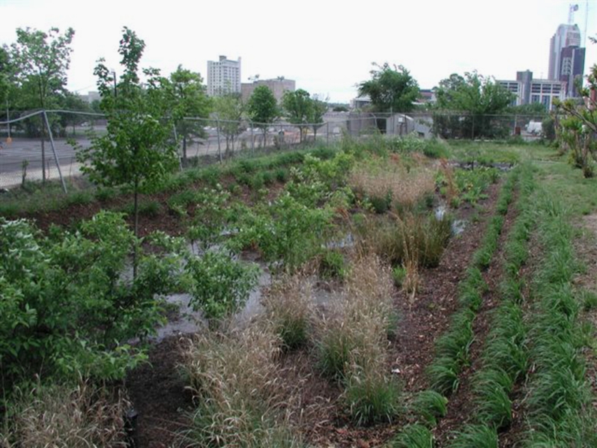
Stormwater retention basins along a river in Liupanshui China. Photo: Kongjian Yu. Right: the Hal Marshal bioretention basin in Cahrlotte, NC. Photo: Willian Hunt.
Retention ponds are certainly not the only tool available to retain stormwater on-site. Green roofs, water harvesting for non-potable use in buildings and as irrigation, and bioretention basins (rain gardens) all have great potential. There is a tutorial dedicated to each of these topics in this class, but to introduce this topic, we can review research into the performance of bioretention basins for stormwater management and take up their water quality treatment benefits later.
A bioretention basin constructed in Charlotte, North Carolina has been well monitored (see image above). The basin is a four-foot deep volume of sandy loam soil over a native soil with a .43" per hour saturated infiltration rate. The catchment area was impervious (an asphalt parking lot). The basin can hold a 6" temporary pool above the soil surface.
The bioretention basin was designed to capture storms of 1” or less. However, for storm volumes of 1.65” (42 mm) the peak storm outflow decreased by 96% . During the study of the basin's performance, the average storm was 1.08" (27.4 mm) and the median storm was 0.95" (24.1 mm) (Hunt, 2008).
This performance is confirmed by a study of a bioretention basin constructed at Villanova University in Pennsylvania. Its catchment area is 50,000 square feet and is 52% impervious. The 4’ deep infiltration basin consistently removes 50% - 60% of the storm runoff from the surface waters. In fact, for storms 1.95 inches and less there was rarely any outflow from the basin at all. This is partly because there is infiltration into the subsoil during the entire storm. Even during a 6” storm the retention basin reduced the storm peak (National Research Council, 2009).
A University of New Hampshire bioretention basin, comprised of a 30” depth of sandy soil, and a 16” depth of gravel below it, displayed an 82% reduction in peak stormwater flow and a 92 minute delay in the storm peak (UNHSC, 2007).
Bioretention basins are most often used as site scale elements instead of watershed scale measures. Therefore, small basins that are practical for residential and commercial lots are emphasized. Added interest in the recharge of groundwater may add requirements that some post-development runoff is to be infiltrated to meet pre-development infiltration rates.
For example, a wooded site slated for low density residential development might typically have a pre-development curve number of 55 (based on the U.S. Natural Resources Conservation Service TR-55 runoff calculation method) and a post-development curve number of 70. An infiltration of .22 inches of runoff volume would be required in the developed landscape to meet pre-development infiltration conditions for a 2” storm. Over a ½ acre site this would equal approximately 400 cubic feet for a 2” storm and could be accommodated in 20’ x 20’ bioretention basin (DER, 2007).
Study Questions
What is the percentage difference in pollution removal for a six batch retention basin compared to a one batch basin?
In the study of the Australian wet pond/wetland comparison, what was the percentage of fecal bacteria removed by the wet pond? What percentage was removed by the wetland?
According to the study results reported by Mallin, how effective are detention basins in the removal of ammonium, nitrate, phosphorus and total nitrogen?
The study of the bioretention basin in Charlotte, North Carolina revealed that the peak runoff was reduced by what percentage?
The study of the University of New Hampshire bioretention basin demonstrated a delay in the peak runoff. What was the delay in minutes?
References
Davies, C, M.; Bavor, H. J. 2001. “The Fate of Stormwater-associated Bacteria in Constructed Wetlands and Water Pollution Control Pond Systems” in Journal of Applied Microbiology 89: 349-360.
DER (Department of Environmental Resources), Environmental Services Division. 2007. Bioretention Manual. The Prince George's County, Maryland
Hunt, W; Smith, J; Jadlocki, S; Hathaway, J; Eubanks, P. 2008. "Pollutant And Peak Flow Mitigation By A Bio Retention Cell In Urban Charlotte, N. C." Journal of Environmental Engineering. May 2008.
Kadlec, R. H; Wallace, S. 2009. Treatment Wetlands. 2nd edition. CRC Press, Boca Raton, FL.
Mallin, Michael; Ensign, Scott; Wheeler, Tracey; Mayes, David. 2002. “Pollutant Removal Efficacy of Three Wet Detention Ponds”. Journal of Environmental Quality. 31:654-660.
National Research Council. 2009. Urban Stormwater Management in the United States. National Academies Press, Washington DC.
UNHSC (University of New Hampshire Stormwater Center). 2007. 2007 Annual Report. CICEET, Durhan, NH.