Lesson 2 Text

1 Introduction

Lesson 2: The Macro Environment
< Lesson 1 |

Climate is one of the most important influences on determining species distribution, competition, disturbance regimes, and ecosystem function. The climate is the combination of the weather patterns, averages and extremes for a given place.

Climate is affected by changes in latitude, elevation, and landforms which then influence vegetation distribution on a global, regional and local scale.


Dave Powell, USDA Forest Service, www.forestryimages.org
LESSON 2
< Lesson 1 |

2 Solar Radiation

Lesson 2: The Macro Environment

Climates are a product of the interaction of solar radiation and the atmosphere (Mackenzie 1998). Solar radiation originates from the sun and provides the light which makes photosynthesis possible and provides the heat necessary to support life. It also drives atmospheric movement, evaporation, and precipitation.


SOHO, ESA / NASA, www.nasa.gov

Only about 30% of the solar radiation which reaches the earth is reflected back into space by the atmosphere, the remaining 70% of the solar radiation is absorbed by the atmosphere, vegetation and the earth’s surface (Barnes et al. 1998).

Solar radiation is selectively absorbed by vegetation to facilitate photosynthesis. However, not all solar radiation is used by plants. Solar radiation can be divided into three types, ultraviolet, visible and infrared. Most plants absorb ultraviolet and visible light waves (Gates 1968). This selective nature of vegetation is why many plants look green.


Arnold T. Drooz, USDA Forest Service, www.forestryimages.org

The amount of solar radiation which reaches a given area of the earth’s surface is dependent upon latitude, time of day, altitude, and atmospheric conditions (Barnes et al. 1998).

LESSON 2

3 Atmospheric Movements

Lesson 2: The Macro Environment

Global wind patterns are caused largely from the imbalance of solar radiation between the equator and the poles. This imbalance forces hot air near the equator to circulate towards the poles and a current of cool air to move from poles towards the equator.


SeaWiFS Project, NASA/Goddard Space Flight Center, www.nasa.gov

As we just mentioned, solar radiation causes the air near the equator to become hotter than the air near the poles. As this air heats up, it rises and leaves a void near the surface of the earth which is then replaced with the colder air from the poles (Barnes et al. 1998). The areas of rising hot air are called low pressure systems. This air eventually stops rising and moves laterally towards the poles. As this occurs, the air begins to cool and sink. Areas of cool sinking air are called high pressure systems.

The revolution of the earth causes air masses to move at different speeds due to the mass being dragged by the surface. This then causes the winds to veer in a particular direction. This is called the Coriolus effect (Mackenzie et al. 1998). Specifically this means that air traveling southwards will verge to the right and northward-traveling air will verge to the left.

Within the tropical zone, between 30 degrees north and south, the cool air masses moving down become deflected to the right and form the northeast trade winds, while the cool air moving north towards the equator are deflected to the left and form the southeast trade winds.


Charles T. Bryson, USDA Agricultural Research Service, www.forestryimages.org

At higher latitudes, between 30 and 60 degrees latitude, the westerly winds are formed by the sinking of the upper air masses. More typically the westerly wind is referred to as the jet stream. Much of North America, Europe and Asia are in this zone where the prevailing winds carrying moisture and storms move across continents from west to east. This area typically has a large variability in weather. This variability also allows for deciduous and coniferous forests, grasslands, and desert


Dave Powell, USDA Forest Service, www.forestryimages.org

Additional Information:
More Information about Winds

LESSON 2

4 Water and Precipitation

Lesson 2: The Macro Environment

The distribution of water across the earth directly influences both the climate and biota at the micro and macro scales. Water is mainly stored in the oceans and the atmosphere, with streams, lakes, ground water and plants holding the rest. The water cycle is the process which transfers water between these components.

As we already mentioned, the atmosphere stores large amounts of water. This water is typically stored in the form of vapor and is commonly referred to as humidity. The temperature of air dictates the amount of water it can hold. The water holding capacity of air increases as temperature increases. The relative humidity is the percentage of water vapor present in the air compared to the amount of water the air could actually hold.

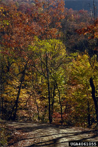
Water enters the ecosystem from the atmosphere in the form of precipitation. Precipitation occurs when a humid air mass cools and it loses its water holding capacity. This process generally begins with the formation of clouds, which are very small drops of water which remain suspended in the air. As these drops grow larger, they become too heavy to remain suspended in the air and they fall to the ground as precipitation.


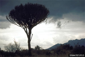
Kenneth M. Gale, www.forestryimages.org

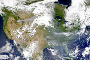
The cooling air masses which cause precipitation can be formed in several different ways, however in all cases the air is lifted to higher altitudes and cooled. Lifting may occur due to the lower parts of an air mass being heated at the surface and rising until clouds form and then precipitation, or a faster moving air mass may push under another air mass in front of it forcing it to rise in elevation. 
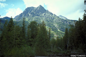
Another cause of rising air masses is through orographic lifting. This occurs when a mass of air is forced to gain elevation due to an obstacle. For example, a mountain range will force an air mass to rise to pass over it.


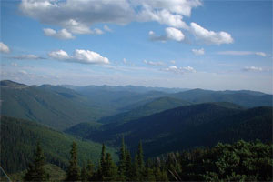
Steven Steele, , www.forestryimages.org

Once water has fallen to the earth’s surface it can either evaporate back to the atmosphere, be absorbed by the soil or roots of plants or it can become ground water. Water is also released back to the atmosphere through the stomata of plants. This process is called transpiration. The combination of evaporation and transpiration account for almost 70 percent of the water returned to the atmosphere. These two processes together are referred to as evapotranspiration.

The relative importance of the causes of precipitation vary temporally, regionally and locally, and the amounts of water evaporated and transpired back to the atmosphere vary with humidity, soil properties and amount of soil water. A complete review of the hydrological cycle is well beyond the scope of this web module.

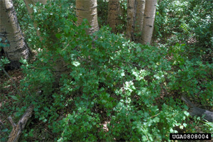
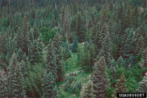
The influence of precipitation on ecosystems is very important as we have already mentioned. In general, forested ecosystems occur where precipitation exceeds transpiration. 
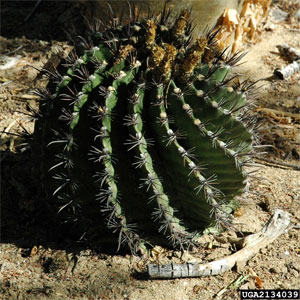
In areas where this does not occur, we typically find grasslands or deserts.

Additional Information:
Water Cycle
Hydrological Cycle

LESSON 2

5 Temperature

Lesson 2: The Macro Environment

Essentially temperature is a measure of average kinetic energy.

In general, the temperature of a location decreases with the distance from the equator. Temperature increases are greatest in areas which receive the most solar radiation, such as areas in the tropical latitudes, high elevations, and where the air is most free from atmospheric impurities. The temperatures at night time are regulated by the amount of heat absorbed and released by the earth’s surface.


William M. Ciesla, Forest Health Management International, www.forestryimages.org

As one moves up in elevation, temperatures generally decrease. In the interior western US where air is not generally saturated with water vapor, an increase in 300 meters of elevation will result in a decrease of 2 degrees Celsius (Barnes et al. 1998). However, as water vapor increases the change in temperature for a given elevation change will decrease.

Other landforms such as large bodies of water also play a large role in minimizing the range of temperatures found. For example maritime climates often do not experience the same temperature ranges as continental climates.


Leonard Newell, USDA Forest Service, www.forestryimages.org

For the most part, vegetation changes with both latitude and altitude as a function of different temperature regimes. This is apparent as one climbs to the top of a mountain peak. As you head up to the summit you will increase elevation, and with this you will see a change in the vegetation. An example of the effects of elevation on vegetation changes is to drive from Phoenix Arizona to the San Francisco Peaks near Flagstaff Arizona. When you begin your trip in Phoenix you will be in the Sonoran Desert, as you begin to climb up in elevation you will begin to see grasslands and then pinion and juniper forests. After awhile you will see ponderosa pine forests, then mixed conifer, and then spruce/fir forests. Finally, after that you reach timber line, you will only see alpine tundra.


G. Keith Douce, The University of Georgia, www.forestryimages.org

Temperature also plays a key role in regulating plant activities. In general plant activities will increase with temperature until some point and then begin to decrease until death occurs.

More Information:
Temperature

LESSON 2

6 Soil

Lesson 2: The Macro Environment
| Lesson 3 >

There are 5 main resources required for the growth and development of terrestrial vegetation (solar energy, carbon dioxide, water, nutrients, and a medium for support). Of these 5 resources 3 of them are provided by the soil (water, nutrients, and a support medium) (Barnes et al. 1998). Soil is one of the most important factors influencing the growth of individual plants and the functioning of ecosystems.

Soil is essentially a porous medium consisting of organic matter, water, gasses and minerals. Soil is produced by the combined influences of weather, topography, biota time, and geological materials (Barnes et al. 1998). The geological materials which eventually make up soils, called the parent material, are formed by the weathering process.

Soils are generally defined as the natural, unconsolidated mineral and organic material occurring on the surface of the earth. Soil parent material include consolidated parent materials such as igneous, sedimentary, and metamorphic rocks, which formed soil in place, and unconsolidated materials which have been formed by the transportation of the parent material by ice, water, wind, and gravity. An example of unconsolidated soils can be found in the eastern United States where glaciers have left behind a landscape consisting of almost entirely of unconsolidated materials.

After parent material is formed it becomes differentiated into horizontal layers called the soil profile. The development of the soil profile is dependent upon the climate, parent material, plants and animals using the soil, the physiography of the site and time (Barnes et al. 1998).


Phil Crawl, USDA Forest Service, www.forestryimages.org
LESSON 2
| Lesson 3 >