Reservoir Characterization
| Modeling the behavior of hydrothermal fluid systems requires reservoir maps, or domain representations, that are based on real physical phenomena. Although we spend our fair share of time working on computers, the Computational Hydrology Program emphasizes the need for highly accurate field data that is representative of the systems we are characterizing. We typically spend anywhere from one to three weeks each summer gathering field data using a variety of methods. We also take time carefully designing our sampling plans to maximize resources and time afield. | ||
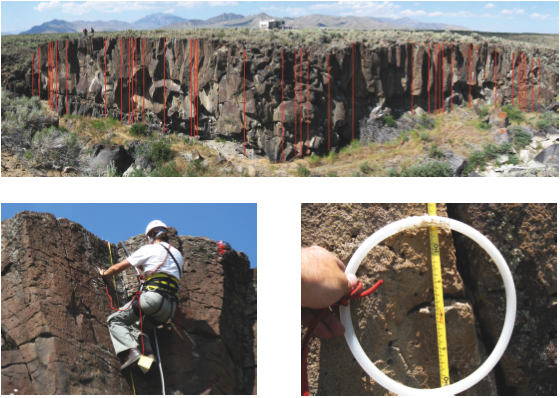
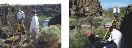
Several projects recently undertaken by Jerry Fairley and his PhD student Ryan Pollyea include characterizing a fractured basalt aquifer in the East Snake River Plain in southeast Idaho. The methods for field data acquisition include rappelling a vertical basalt outcrop and using terrestrial light detection and ranging (LiDAR) technology. Due to the enormous volume of data returned by the LiDAR scanner, specialized software was developed for the analyses. The wide variety of projects in the Computational Hydrology Program provides students with excellent field research opportunities. For more information, contact Dr. Jerry Fairley at jfairley@uidaho.edu. |
||
 |
Sampling fractured rock using a low-tech, but exceedingly fun, approach! Here, graduate students are spending their time rappelling the rock face and collecting spatially referenced fracture location data. |
|
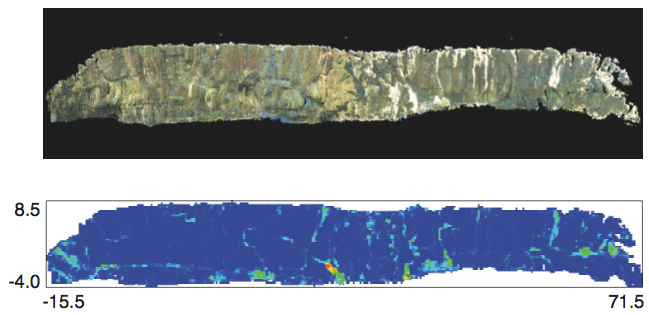
| We also use exciting new terrestrial LiDAR technology to get field data. The volume of data returned by LiDAR scanning requires us to write our own software for analysis! The top image below is an orthorectified LiDAR image of the scanned outcrop; and the bottom image is a surface roughness map used to identify fractures in outcrop. |


|


